One-stop geospatial data analysis platform


Do you need an infrastructure to analyse geospatial data? Do you need parallel, distributed, or GPU-assisted computing capabilities for machine learning and AI applications involving (big) geospatial data?

You are at the right place.

Welcome to the ITC Geospatial Computing Platform!

Find Out More

We've got what you need!


Based on the user needs assessment we have designed and implemented a computing infrastructure to serve high-priority activities, such as exploratory research, prototyping, and self-learning. It is tailored for big data analysis, but feel free to use it for other geospatial computing needs!

Geospatial Computing Platform


Containerized

Each working environment is containerized and isolated from each other and also from the host unit to ensure privacy.

Powered by Docker

Distributed

Built on a cluster of computing units, the platform scales automatically and balances workload among the units.

Powered by Docker Swarm

Replicated

Your assets are protected against hardware failures through replicated storage with minimum two physical copies.

Powered by ZFS

Powerful

Each computing unit has 8-core ARM v8.2a 64-bit CPU, 512-core Volta GPU with Tensor Cores, and 32GB 256-bit LPDDR4 RAM.

Powered by Jetson AGX Xavier

Ready to Use

Software packages are ready to use out-ot-the-box, without any further setup required.

Up to Date

Software packages are kept current to allow the use of latest, state of the art features.

Optimized

Software packages are fine-tuned for best performance utilizing high-performance, multi-threaded libraries.

Energy Efficient

Computing units operate at 10–30W ensuring low energy footprint, albeit high performance.

Platform Components


The platform utilizes innovative hardware and state-of-the-art software components to provide a highly-available and performant computing environment.

NVIDIA Jetson AGX Xavier

Small, But Talented

NVIDIA Jetson AGX Xavier units with 1 TB local and 200 TB network storage connected through Gigabit Ethernet empower the platform.

Powered by JupyterLab

Interactive

Interactive Jupyter notebooks provide easy to use and user friendly data analysis and visualization environment.

Powered by JupyterLab
Powered by Dask

Scalable

All units in the platform and their GPUs are available for distributed out-of-core geospatial data analysis purposes.

Powered by Dask and Apache Spark
Multiple programming languages are supported

Multilingual

Multiple programming languages can be used to access platform resources and perform geospatial computations.

Available on the Platform

Apache Hadoop
Apache Spark
Dask
CUDA
OpenCL
OpenMPI
OpenMP
UCX
TensorFlow
Keras
PyTorch
MXnet
Scikit-learn
Scikit-CUDA
XGBoost
RAPIDS
GDAL
Proj
Cartopy
Geopandas
Geopy
Iris
PySAL
RasterIO
Numpy
Numba
Pandas
XArray
NetworkX
igraph
ONNX Runtime
TensorRT
OpenCV
Scikit-Image
FFMpeg
ImageMagick
GraphicsMagick
matplotlib
FFTW
Apache Arrow
VS Code
RStudio
Octave
Statsmodels
Altair
Seaborn
Bokeh
HDF5
and many more...

Additional Services


Quite often you may also need additional services, such as a database to store your data, a map server to publish your maps, a data repository to share your research data. To facilitate and support your work we provide some out-of-the-box services!

GeoServer

GeoServer

Open source server for sharing geospatial data

Access
MapServer

MapServer

Open source platform for publishing spatial data

Access
PostgreSQL

PostgreSQL

Open source relational database

Access
MariaDB

MariaDB

Open source relational database

Access
GeoNode

GeoNode

Open source geospatial content management system

Access
The Dataverse Project

Dataverse

Open source research data repository software


Access
Gitea

Gitea

Open source lightweight code hosting solution

Access
Open Data Kit

Open Data Kit

Open source platform to collect data quickly, accurately, offline, and at scale

Access

Frequently Asked Questions


Below you can find answers to some questions about the computing platform and related services. Please visit the Support Center Knowledgebase for more!

How can I access to the platform?

You can access to the platform at https://platform.crib.utwente.nl/geospatial/ by using your personal University of Twente account (i.e., e-mail address and password).

Unless stated otherwise, all additional services (e.g. GeoServer, Gitea) can also be accessed in the same way. Each service may require you to sign in separately.
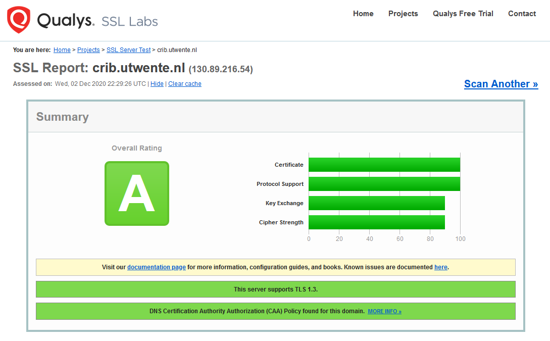
Is it secure?

Your connection to the platform is secure (i.e. encrypted) and has A rating from SSL Labs.

Your working environment is created on demand and isolated from the others which are active on the platform. Therefore, your assets (e.g. files, documents, images, etc.) are only accessible to you.

The platform uses University of Twente LDAP service to authenticate your credentials also through a secure connection and does not store your password.

How can I use the platform?

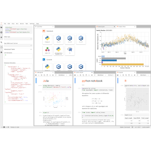
The default interface of the platform is JupyterLab, which enables you to work with interactive notebooks and documents through text and code editors, terminals, and other custom components (e.g. map widgets).

If you are new to JupyterLab (or Jupyter notebooks in general), a good starting point is its official documentation, which includes a detailed user guide. There is also a nice and short (~ 6 min.) introduction video available.

For specific components integrated to the platform (e.g. Code Server), please refer to their own documentation.

Which languages are supported by the platform?

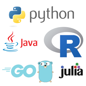
The platform has kernels for Python, R, Go, Julia, Java, Scala, PHP, Ruby, Octave, dot, and gnuplot, which you can use in interactive notebooks. All these languages are also accessible through the terminal interface. By using the terminal you can also use C, C++, Fortran, Perl, and CUDA. Complete list of languages with versions are listed under public/platform folder on the platform.

Which libraries and packages are supported by the platform?

Complete list of system packages (including low-level libraries, e.g. OpenBLAS, ATLAS, PROJ, GDAL, etc.) and language-specific packages (e.g. Python and R packages) are listed under public/platform folder on the platform.

Why the latest version of xxx is not available?

We do our best to make the latest versions of software packages and libraries available. However, occasionally certain versions of the packages are not compatible to each other or not fully supported by the platform architecture (Linux / ARM v8.2a) - so we have to choose. If you are not happy with the selection please let us know.

Why xxx is not available?

We are trying to make widely-used software packages and libraries available with a special focus on geo-information and Earth observation. In fact, we did a survey to understand your needs and determined the list accordingly. We will periodically review this list and add more packages.

If the software package you need is not available on the platform (yet), the reasons could be:

  • We may not be aware of it. Just contact us and tell us what you need. Most probably we can make it available quickly, especially if it is an open source software.
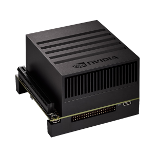
  • It might be a package we are currently working on. Some packages have a long list of dependencies and they are difficult to setup, especially on a platform composed of special units (i.e. Jetson AGX Xavier) which are quite different from standard equipment (e.g. servers). Probably we solve all the issues and make it available soon.
  • It might be a package that is not supported by the platform architecture (Linux / ARM v8.2a). Unfortunately such software packages exist (e.g. Microsoft Windows applications). But there might be some alternatives available and we can help you to find them if you contact us.
  • It might be proprietary requiring a license. Currently we don't support such software packages, but this may change in the future. Please let us know if you need such software products.

Can I install software packages?

Sure. System-wide packages are protected, but you can install additional software packages to your workspace (i.e. home folder). For Python, you can use pip. For R, you can use install.package() command. Please contact us for other languages and low-level libraries.

Would you like to stay informed?
Subscribe to our newsletter!

Sign Up Now!

Contact


Do you have question on the platform and related services?
Do you need additional software packages and services?
Are you interested in collaborating with the Center of Expertise in Big Geodata Science?

Contact us to share your questions and discuss the possibilities!